Jul
14

Day 29) Rawlins (Day Off)

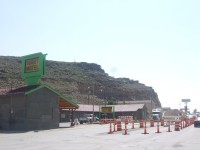
We really wanted a lie-in after our epic cycle yesterday, but we got up for the cereal, toast, donuts and coffee available in the hotel lobby. After using the internet and watching rubbish reality TV, we ventured into Rawlins to try out the Thai Buffet recommended by Tony last night. It was really hot and the area around our motel was full of roadworks, so the walk wasn’t very pleasant, and we weren’t entirely sure where we were going as we had arrived in a car in the dark. We found the restaurant and had a delicious lunch and a stroll around town. Rawlins was a strange place really. It seems like the place could do with a bit of investment. Tony told us that there are a lot of business and construction companies in the area for the gas or oil (I can’t remember which), but you can’t see anything of the benefits of this gas/oil in the town.

On reading the blog of our fellow cyclist, Alan, whom we had met along the way in Oregon and Idaho, we found out that he had arrived in Rawlins last night. Thanks to our long cycles and a little help from Tony we had caught him up. He wasn’t having a rest day today though, so we’d be a day behind him, but could maybe catch him up before we leave the Transamerica route in Breckenridge, Colorado.

Summed up:

A nice relax and a great feed

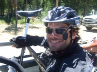
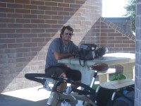
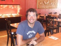
Ryan looking pleased with himself after the Thai buffet

Ryan looking pleased with himself after the Thai buffet

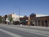
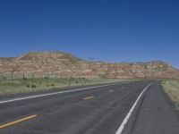
Rawlins could definitely use some work

Rawlins could definitely use some work

Jul
13

Day 28) Lander to Rawlins!

Today was always going to be tricky; the services along this section were limited, as were the campgrounds and the terrain was boring and the weather hot. We set on our way, with 3.5 litres of water each, planning to make it to Jeffrey City where our map advised us we could camp in the park. There was an uphill section today, but there was a store near the top so we should have managed the 39 miles with our 3 litres of water. Some days we’d do 60 miles and not drink it all. However, we were wrong! It was so hot and the climbing relentless. There was no shade to stop for lunch and the riding was gruelling. We stopped beside the road for lunch again, with no shade and no nice store to sell us a cold drink. About 10 miles from the Sweetwater Station service stop we were heading for, we found a tree beside the road where we took some shade. Our water was very low. I had about 1/2 a litre and Ryan had less. We had our water pump that we had purchased in Missoula, but it was no use as all the creeks we had passed were dry (we hadn’t thought about that). Just as we were day dreaming that someone in a huge RV would pull up and offer us some cold drinks, a car pulled up. The lady shouted to us asking if we needed any water. How amazing! We yelled back that we did and she got out of her car and proceeded to pull some small bottles of water from a box in the back. She said that she had seen us sitting there in the tiny patch of shade and something had told her that she should offer us some water. She had driven on for a mile or so until she could find somewhere to turn around and then come back to us. How kind! She gave us four 500ml bottles. We guzzled one each there and then.

When we finally reached Sweetwater Station we were elated. For miles I had been thinking what I was going to buy; a chocolate bar, a nice juicy orange and a cold can of pepsi, as a reward for my efforts. As we got closer we realised that the store wasn’t just closed, but closed down. It looked like it had been for years! We hadn’t bothered to read the supplement that came with our map, telling us of any changes. It probably would’ve told us that this place was closed. Thankfully a little way back was a picnic area which had a cold water drinking fountain, so at least we could have a cold drink. We also raided our bags for snacks and had our second lunch under the shaded picnic area.

We carried on our journey to Jeffrey City, hoping to pitch our tent in the park and get a bite to eat in town. When we finally arrived at 7pm we were in for a shock! What a strange place?? Jeffrey City had been built in the 1950’s as a Uranium mining town and at it’s heyday in the early 1980’s, 5,000 people lived here. It had a high school, a multi-million dollar olympic swimming pool and modern duplex apartments. But now the population was 50 people and it was like something from the Twilight Zone or Twin Peaks. I went into the only “restaurant/bar” and the locals seemed equally fit for the Twilight Zone, all staring at an old TV set above my head and no one really acknowledged me. I enquired about camping in the park, to which the bar man didn’t give me much of a positive reply, but to be honest I didn’t want to sleep in the park! There was a “buffet” dinner on offer in the restaurant which consisted of a pot full of beef burgers and another pot of chilli. When I went outside Ryan had met up with Jim, another cyclist whom we had been seeing on and off since Colter Bay. He was riding with Bob and they were always away really early in the mornings, but we had been catching them up in the evenings. Jim and Bob were staying in the motel at $70 a night. It looked rough and we refused to pay for it, so we filled our bottles up in Jim and Bob’s room and got back on the road for a 23 miles cycle to Muddy Gap – the next campsite symbol on the map.

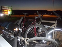
About 6 miles along the way I saw campsite sign and saw Ryan, who was a way ahead of me, pull into a side lane. Woo hoo, I thought. A new campsite that isn’t on the map. My heart sank when Ryan appeared back from the lane and advised me that the campsite was 11 miles along the lane. Oh well, stay positive and just keep on cycling. If we kept up a good pace we should be there before dark. I’ve no idea how we managed it, but we arrived at Muddy Gap at about 9pm after cycling 83 miles! It was just getting dark and we saw no sign of a campground. Thankfully there was a service station with a big sign advising it was open until 10pm. Great, they’ll know where the campground is. We pulled up to the door, only to see a sign telling us they closed at 7pm on Sundays! Ahhhh, disaster. What were we going to do. The next campsite was about 11 miles away, but it was to the rear of a café and the café would be closed by now. We tried not to panic and contemplated pitching our tent beside the petrol station, but it was right in the view of the main road and probably not the safest place to camp. We were jut about to cycle a mile further to see if the campground appeared when a truck pulled in. Ryan went to ask they guy if he knew of a campground around here. The driver was a guy of about our age called Tony. He had been in Lander for the weekend and was driving back to Rawlins. He knew of no campground around here, but if we were heading to Rawlins we could put our bikes in his truck and he’d give us a ride! Wow! What amazing luck. We didn’t want to camp beside the petrol station and we did want to get to a motel in Rawlins so we accepted the offer. This would save us 40 miles of cycling and put us a day ahead of schedule. Tony was a great guy who loved hiking. He had hiked the whole Appalachian Trail alone, which is a 2160 miles continuous marked footpath from Maine to Georgia, in winter time! He also did a lot of night hiking. Being used to hitching lifts into villages to resupply, he said that he could recognise on our faces that we needed help and was happy to repay the favour.

Tony dropped us in the budget motel area of town, where we thanked him and checked ourselves into a Travel Lodge, with a bath, WiFi and a free continental breakfast. The day didn’t turn out so bad after all!!

Total climb:

3314 feet

Summed up:

A disastrous day that would have been far worse without the help of our 2 guardian angels
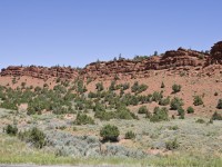
Cool red hill near Lander
Cool red hill near Lander

Our stop at Sweetwater
Our stop at Sweetwater

Our bikes loaded into the back of Tony\'s truck

Our bikes loaded into the back of Tony's truck

Elevation Profile

Total Distance:

84.100 mi

Total Time Cycling:

10h 33m 13s
Jul
12

Day 27) Dubois to Lander

As usual we struggled to get away early. There wasn’t much between Dubois and Lander, 70 odd miles away, so we had a long day ahead of us. The tailwind that had whisk us into town yesterday decided to change direction a few miles out of town and so we also had a headwind to deal with. We met a fellow cyclist going the other way who was delighting in his tailwind. He told us there was a climbing festival on in Lander and that loads of people were camping in the town park – that sounded fun.

For the rest of the day the scenery wasn’t spectacular. The open plains and Sage brush were a novelty to begin with, but the view soon got a bit boring. It was hot and we were tired. When would Lander finally appear?! I had just commented to Ryan that we hadn’t seen many (or any) Native America Indians since we’d been here, when we came upon Fort Washakie. It’s a small town about 10 miles outside Lander, quite shabby looking, and as we pulled into the service station I noticed that everyone entering or leaving the store was Native American. Then I glanced at all the people in their cars and everyone was Native American! It was really odd. I guess that society around these parts is not at all integrated. Ryan and I have found this awesome drink over here called “Sobe” – it’s like a fruit juice and comes in loads of different flavours in a lovely glass bottle. We’ve been drinking it whenever we can since we’ve been here. This store sold it from the self service drink dispenser! Woo hoo! It was so much cheaper this way and we guzzled a whole 44 oz cup. The sugar rush caused Ryan to almost sprint into Lander!

We reached Lander after 8pm and made our way to the City Park on the outskirts of town. It was a lovely huge park, with toilets, tennis court, children’s play area and loads of open grassy space with a little stream running through it. As we were pitching our tent amongst all the other tents (there must have been about 60 others) a girl and 2 guys pulled up on their bikes. It was a couple, Katie and John from Portland, Oregon, and the guy from the local bike shop. John’s bike had broken today and they had hitched a lift into Lander to get it fixed. They were riding the Transameric as well, but were covering many more miles than us each day, between 80 and 100 miles! They had bought some beers to share with us and we sat around drinking and chatting. The bike shop guy invited us back to his house and said we could cook some dinner if we wanted. It was such a kind offer, but it was already nearly 9pm and I was so exhausted from our longest ride yet, 76.5 miles with a headwind! We ended up grabbing a pizza in town and hitting the hay. John and Katie were taking a rest day tomorrow, but they’ll probably catch us up and over take us over the next few days.

Total Climb:

1885 feet

Summed up:

Shouldn’t have been too hard but with the headwind…..

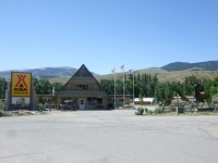
The KOA in Dubois, a really great campsite

The KOA in Dubois, a really great campsite

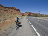
An interesting canyon soon after leaving Dubois

An interesting canyon soon after leaving Dubois

A real Motley Crew!
Lander

Lander

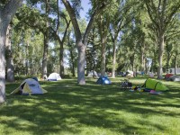
Tent city

Tent city

Elevation Profile

Total Distance:

76.366 mi

Total Time Cycling:

7h 44m 21s

Jul
11

Day 26) Colter Bay to Dubois

We managed to get up early and get down to the waterfront for first light. It was lovely, even if we were half asleep. We were packed up and away by 7.30am – managing to fight the urge to get out of the cold and get back into bed. Today we had a big climb over the Togwotee Pass. It was good to get going so early as we knew we didn’t have to rush. The restaurant halfway up the pass was our aim. The restaurant appeared before to long and we were surprised how little trouble the climb was giving us. We were a bit early for the restaurant, so instead of waiting around we just got some microwave meals from the little store and put them in their microwave. This is so common in the States and a great way to get a cheap feed. We had a long rest and called our families for a chat.

The second part of the Togwotee Pass was riddled with roadworks and twice we had to cycle as fast as we could behind the lead car while all the traffic trailed behind us. It was only for a short distance (less than a mile), but it was uphill and we couldn’t stop. When we finally made it to the top, we were relieved and also proud of ourselves as our fitness had obviously improved and we’d made easy work of the climb. There were more roadworks a short way along and this time they put us in the back of a truck for 6 miles – why couldn’t they do this on the uphill section rather than the fun downhill!? We had a tailwind for our decent in Dubois, which meant that we hardly had to peddle.

We stopped at the store in Dubois to buy a treat for dinner and then settled ourselves into the lovely KOA campground. It was the nicest campground we had stayed at so far. The fajita dinner was a little tricky to prepare with one small pan and no chopping board, but it was worth it and we had some leftovers for tomorrows lunch, which the lady on reception kindly let me store in the refrigerator in the store. We got some washing done and used the wireless internet to try to get our blog more up to date.

Total climb:

3822 feet

Passes climbed:

Togwotee Pass – 9658 feet

Animal Alert:

A field full of maybe 30 elk

Summed up:

The climb we had dreaded for days really wasn’t too bad

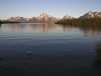
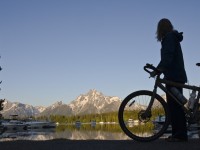
The Tetons at dawn

The Tetons at dawn

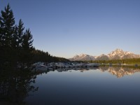
What a harbour

What a harbour

Carly admiring the view

Carly admiring the view

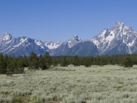
What a cool mountain range

What a cool mountain range

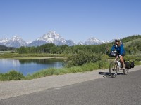
Cycling along by the Tetons

Cycling along by the Tetons

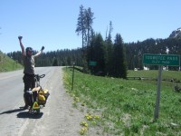
We made it... the highest pass yet

We made it... the highest pass yet

At the top of Togwotee Pass

At the top of Togwotee Pass

In the back of the truck

In the back of the truck

A total change of scenery

A total change of scenery

Elevation Profile

Total Distance:

65.676 mi

Total Time Cycling:

7h 32m 33s